Living on Cutover Land
Maps of meaning, historical and personal
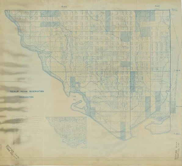
The map shows a wagon road winding its way through one corner, the corner that focuses my attention. There are skid roads, too, marked by dashed double lines leading to a sawmill next to the Great Northern Railroad line. Another skid road ends at a shingle mill close by.
In that northeastern corner, a surveyed section—640 acres—is marked off just like every other section on the map. Within each section, a timber cruiser left his calculations. According to this 1912 map, the section I care about included 1,960,000 board feet of timber. That’s enough to build about 100 good-sized homes. Almost half of it came from Douglas firs, the rest distributed between cedar, hemlock, and spruce. The cruiser identified about 40,000 board feet suitable for pilings (think wharves) and 140,000 board feet good for poles (think telegraph). The cruiser’s eye aimed at products, not simply tree species.
By no means is this section of land exceptional for its timber productivity. Western Washington’s densest old-growth forests could provide 10 times that volume of wood. But the land is notable to me, because I grew up there. These hints of what the land looked like 11 decades ago ignite my imagination.
Where I grew up, Stimson Lumber ran the show; where I live now, it was the English Logging Company. They were important companies at the time in their places, but not behemoths like Weyerhaeuser which had bought 900,000 acres in 1900 and dominated the state. Still, dip into the history books and you can find their imprint.
While researching the short forest history book I’m coauthoring, I pulled off my shelf a book by Erik Loomis, a friend, Empire of Timber: Labor Unions and the Pacific Northwest Forests. I found that, in 1917 to save money, Stimson fired a cook at a logging camp near where I run most Sundays. In protest, forty loggers walked off the job. Before my research, I did not “see” that place as a site of labor unrest, a locale that revealed history. The people who live there now, whose conservative politics shout from their bumper stickers, would be stunned to know that radical loggers in the Industrial Workers of the World tramped through these same woods, plotting revolution.
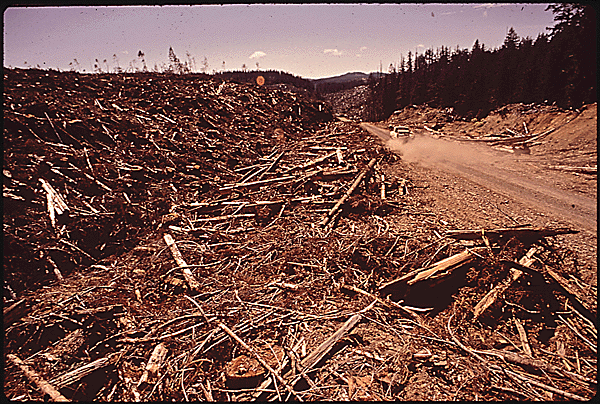
The ubiquity of this history here shouldn’t surprise me. The road that passes my house today began as a logging railroad. The view from our house takes in a bay where rafts of logs floated on their way to mills. The forest behind and above us awaits its third (I estimate) cutting. In other words, the evidence of logging in western Washington is everywhere, if you look, but often you must look with imagination.
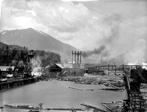
Take that map. The sawmill and shingle mill that the skid roads carried logs to left no obvious traces on the land. These operations were small. A history published a few years before the map said about 40 men worked for Stimson in Marysville producing 200,000 shingles a day the previous decade. That did not include the shingle mill in my “neighborhood,” which was well beyond the outskirts of town.
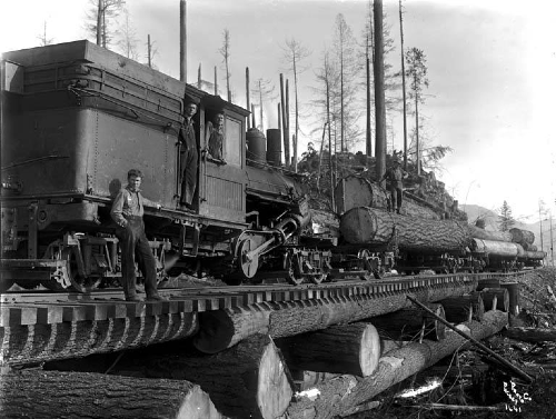
The timber mills that remain in 2026 are such large operations that it is easy to forget that the industry started with small concerns that fed local needs. Later, located near waterways or rail lines, they connected to growing populations around Puget Sound and beyond. Later still, roads and trucks did the work, expanding the range of what forests could be cut.
I don’t have evidence for how long the mills near my childhood home lasted, but no trace on land or in memory remained when my family arrived a half-century later. Although some parts of western Washington were cut repeatedly as part of a company’s long-term cutting cycles, other parts were cut and abandoned. The timber industry has often been fleeting.
Along with imagination, you have to bring curiosity—and a willingness to wait for answers that may not come. For instance, the map’s focus is the Tulalip Indian Reservation, bringing to mind questions about belonging and benefits hidden behind the statistics and geographic features.
The map shows a few mills all outside the reservation boundary. Were mills not allowed on tribal land, even though the trees being sawed came from it? Did the tribal members work in the woods as loggers or in the mills as sawyers? When did the more thickly forested part of the reservation get cut and how did that affect economic patterns of gathering? Much of the reservation today remains well forested but not with old-growth trees, so when did the biggest trees get cut—and who profited? What to make of the inset map with names of individual allottees of land who were supposed to make a living from acres of trees? All these questions arise from the map and wanting to understand a decades-long process of demographic, economic, and political transformation in the place I called home. These are mostly the questions of a historian but applied to a familiar place.
Often I’ve hesitated to investigate things close to my own life. I didn’t want my career to be memoir disguised as scholarly history, as some people I know have done. But when you live on cutover land, forest history starts to affect how you see your home and what you remember.
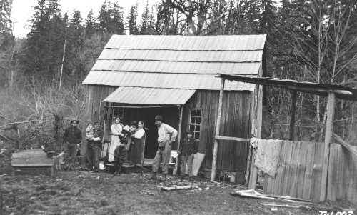
In the woods behind my childhood house my family spent most Labor Days, cutting trees that we used to heat our home through winter. On occasion, one of my brothers and I headed to the woods with an ax and a hatchet to cut down some small alders for fun. I recall seeing springboard notches in a stump or two and learning how loggers used them. My dad, who came to this land as a laborer before buying it, remembers big stumps around the property. These are things I have known for a long time without giving them much deeper thought. Now immersed in forest research, the context of what I’ve known has changed. And for me, that deepens my relationship with place.


Comments ()